Ongoing
since May 2025
Geophysical survey
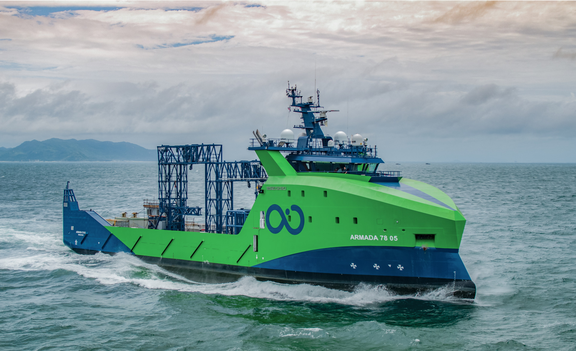
Armada vessels A7804, A7805, A7808
Figueira da Foz and Leixões areas

Ongoing
since September 2025
Geotechnical survey
Armada vessels A8601, A8603
Figueira da Foz and Leixões areas
Objectives
The 2025 survey will provide high-resolution mapping and characterization of the seafloor and sub-seafloor geology and structures, with relevance for OWF instalation.
The 2024 results will be expanded by increasing the spatial data density in 10 times and acquiring additional data sets, for the PAER areas of Figueira da Foz and Leixões.
Survey details
Operation
The execution of the 2025 geophysical survey was contracted to Ocean Infinity.
Ocean Infinity uses an innovative fuel-efficient vessel fleet where a skeleton crew ensures all the onboard operations for geophysical and geotechnical data acquisition. Data QC, processing and payload are conducted real-time in a remote control center.
Vessels 7803, 7805 and 7808 of the Armada fleet – class 78, are used to collect all types of geophysical and geotechnical data during the 2025 geophysical survey.
This solution allows to acquire all types of geophysical data (MBES, SSS, SBP, SCS or MCS, TVG/MAG) at single pass on each survey line.
The project team participates closely in real-time monitoring and decision-making processes at the Ocean Infinity’s remote operational center in Gothenburg.

Geophysical survey
Survey lines for geophysical data acquisition were planned to provide high horizontal resolution, with main lines spaced of 150 m and cross lines spaced of 300 m.
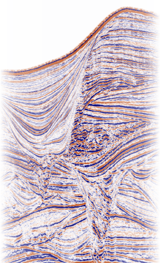
A final highly detailed Geomodel will be produced, including seismostratigraphic interpretation and hazard assessment.
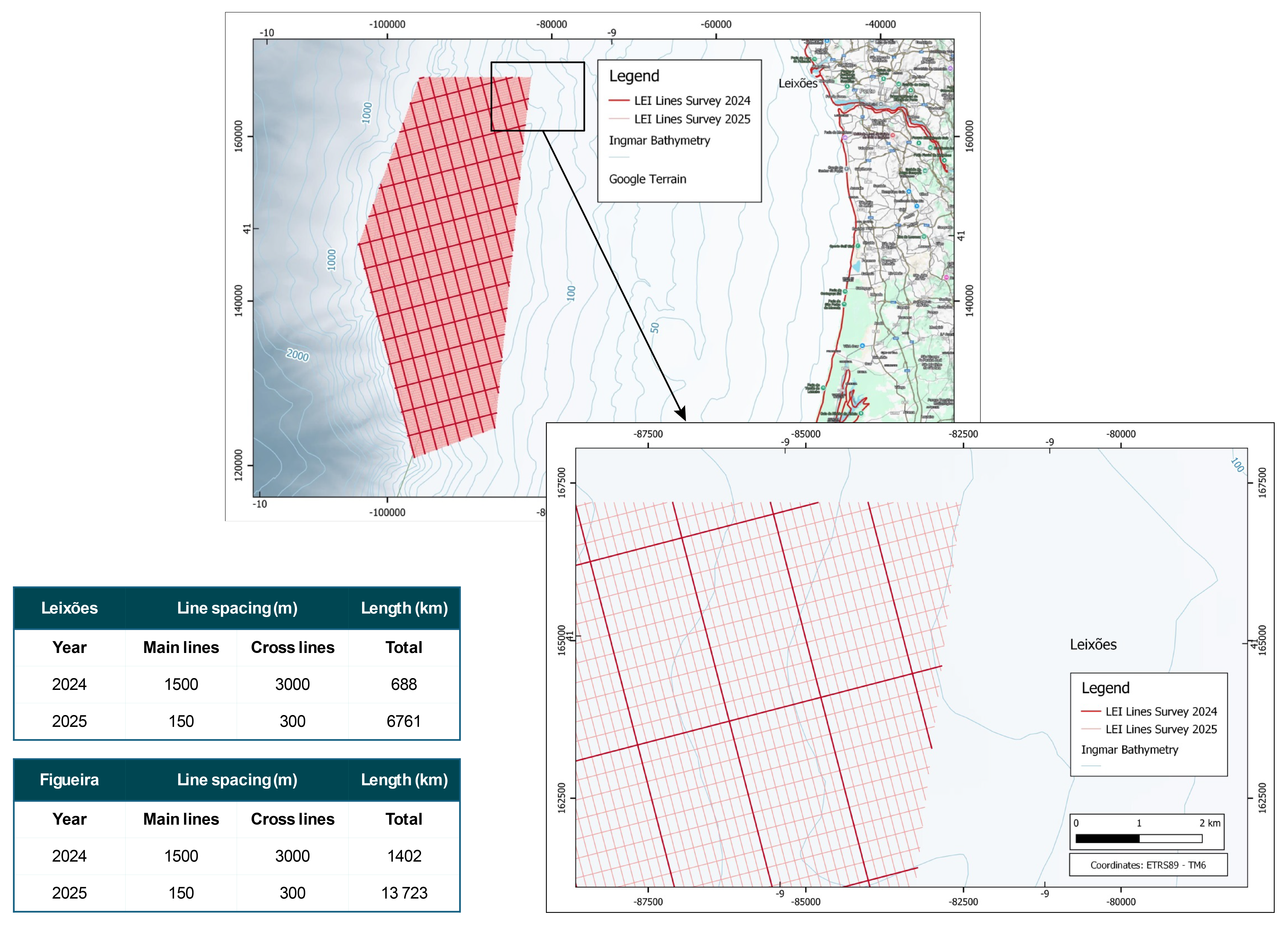
Detail for the Leixões area: thick lines – 2024 survey; thin lines– 2025 survey (10 times increase in line density).
Planning
The 2025 survey is organized in 4 lots:
Lot 1 – Geophysical survey
>> Lot 1a – Leixões
- 170 main lines
- 149 cross lines
- total length – 6761 km
>> Lot 1b – Figueira da Foz
- 225 main lines
- 180 cross lines
- total length – 13 723 km
Lot 2 – Geotechnical survey
>> Lot 2a – Leixões
- seabed grab samples: 68 stations
- Vibrocores: 34 stations
- ‘deep’ push seabed CPTs: 14 stations
>> Lot 2b – Figueira da Foz
- seabed grab samples: 138 stations
- Vibrocores: 69 stations
- ‘deep’ push seabed CPTs: 29 stations
Geotechnical investigation
All geotechnical datasets are processed for laboratory testing, processing and reporting.
Sediment and ecological analyses include:
- Identification of trace metal concentration (As, Cd, Cu, Cr, Hg, Pb, Ni, Zn)
- Identification of the concentration of persistent organic pollutants (PAHs, PCBs, HCBs)
- Characterization of benthic macrofauna.
Geotechnical results will support decisions on layout and design of foundations/anchors of floating wind turbine generators (WTG).
Survey partners
>> Survey contractor
>> Consulting in survey management
>> Seismic data acquisition

>> Seismic processing and interpretation
(Geomodel)

>> Client representatives

>> Client representatives

>> Client representatives
>> Survey management consulting
>> Geotechnical consulting
