Desktop studies were developed during 2024, prior to data acquisition or sampling, and consisted on bibliographic review and interpretation of the existing information and data on:
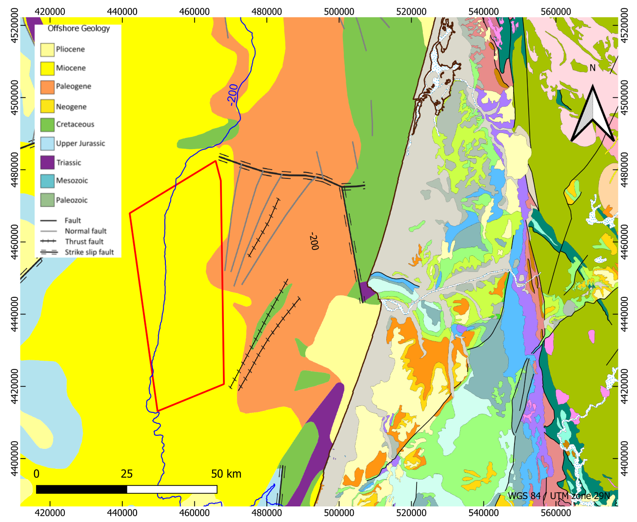
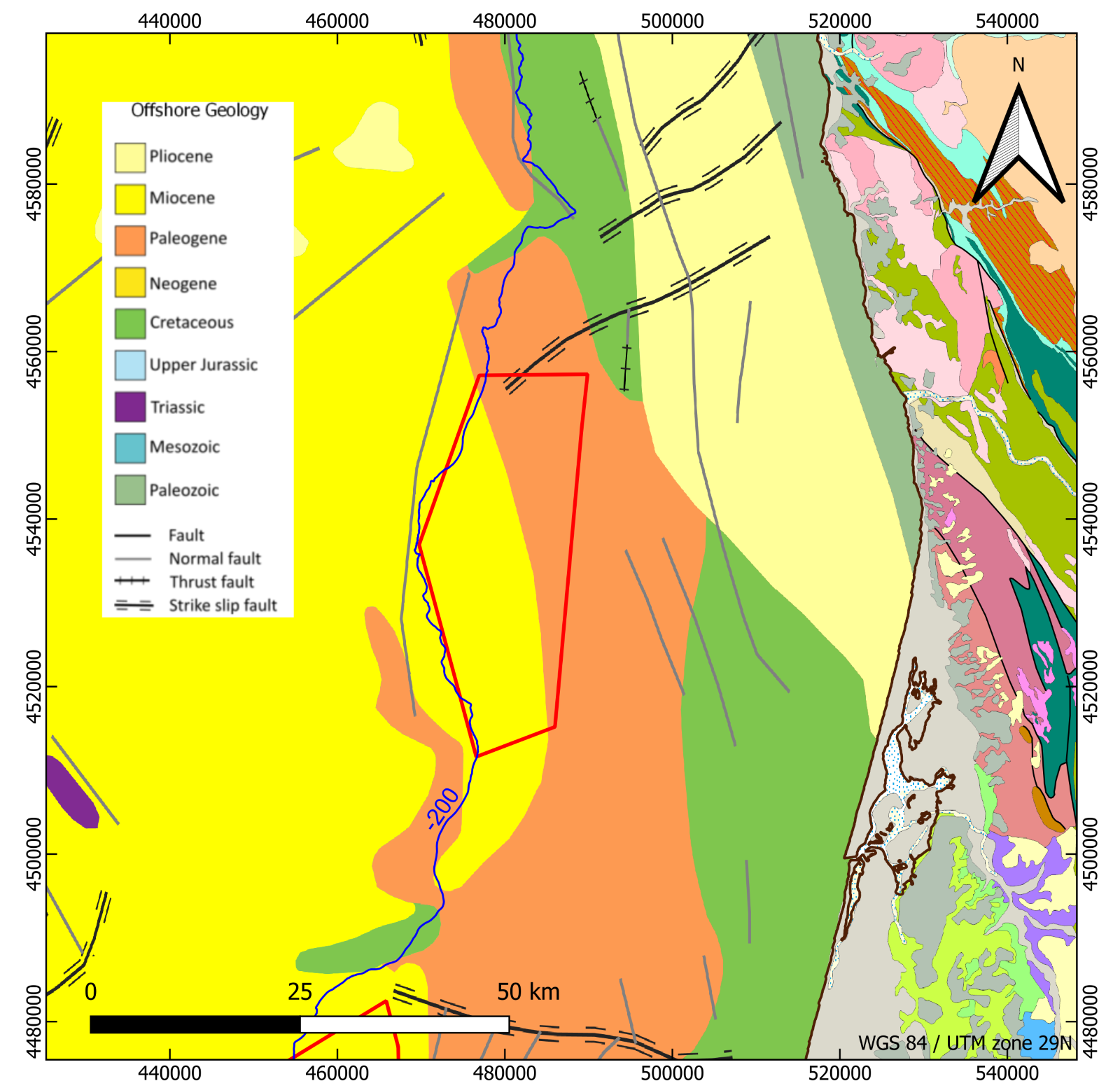
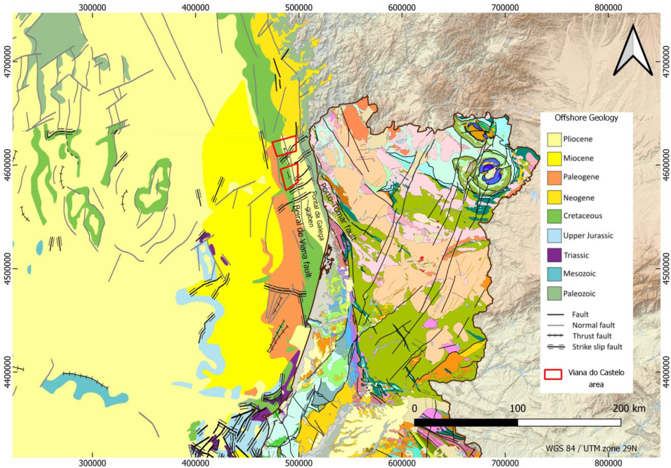
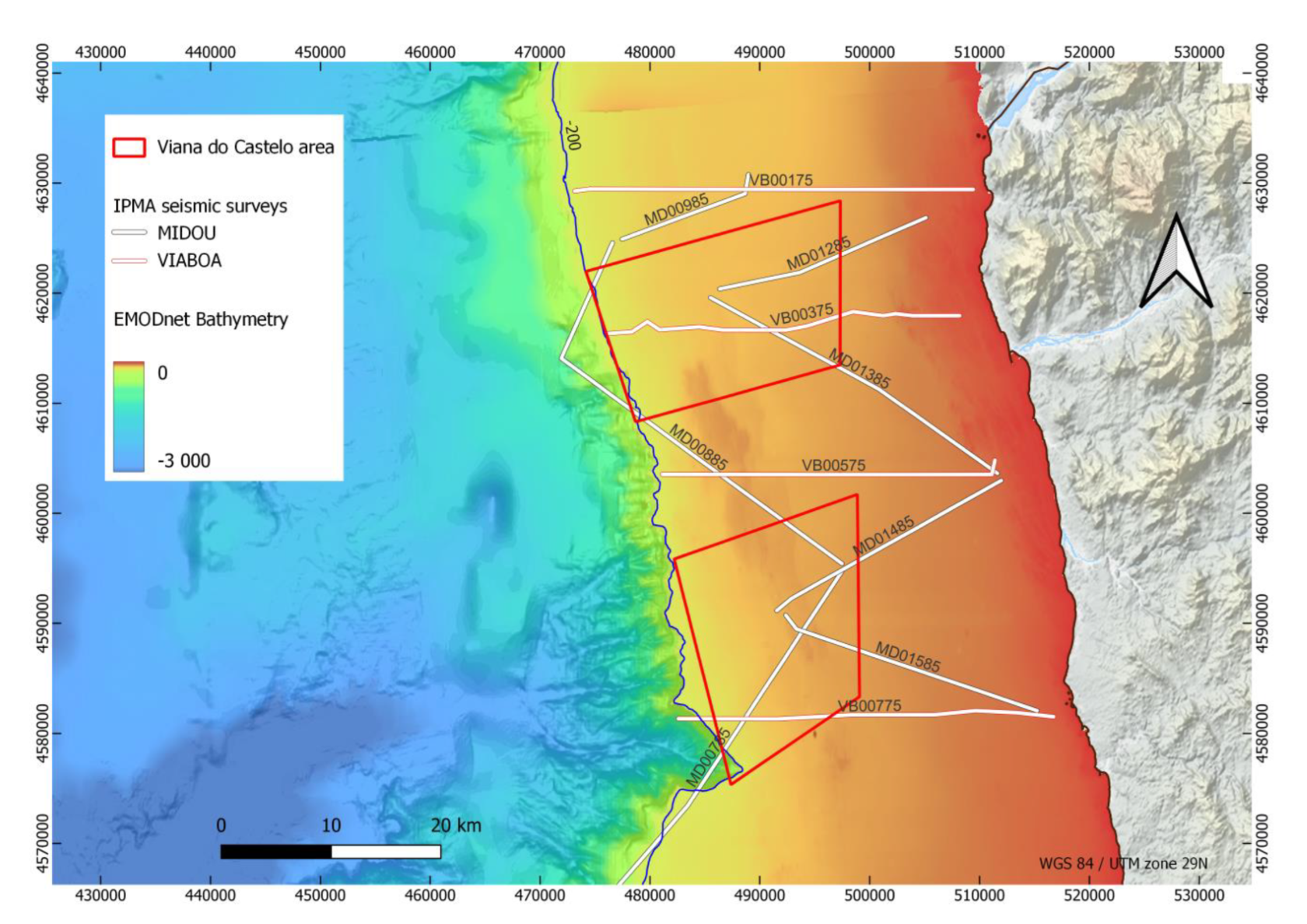
Geology
Preliminary technical reports on the geology of the areas were produced by the SEISLAB team using existing geophysical data.
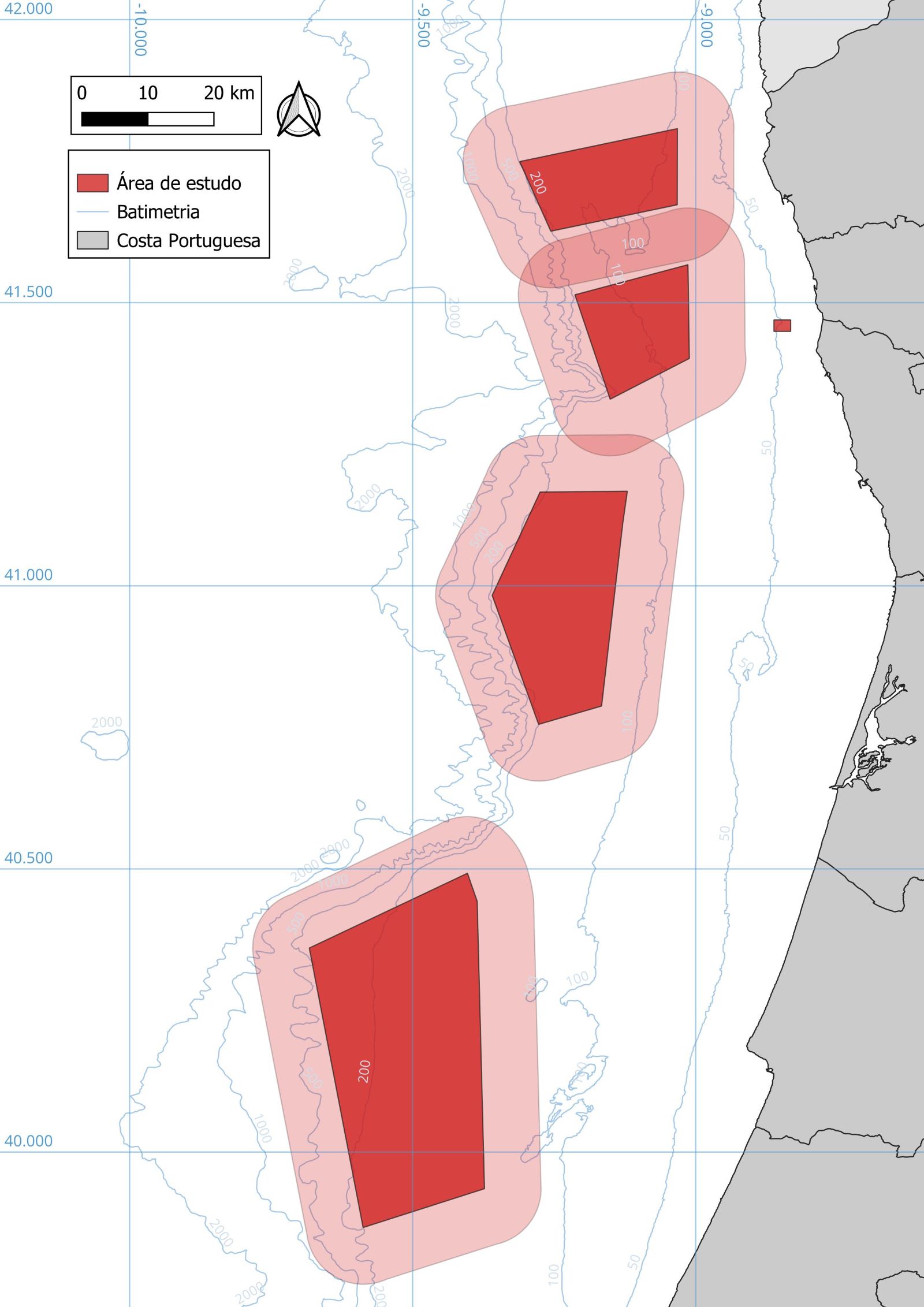
>> PAER areas: Viana do Castelo, Figueira da Foz and Leixões
Aims:
- Infer the expected thickness range of surficial sediments
- Infer the existing lithologies
- Help planning the 2024 and 2025 surveys
Datasets:
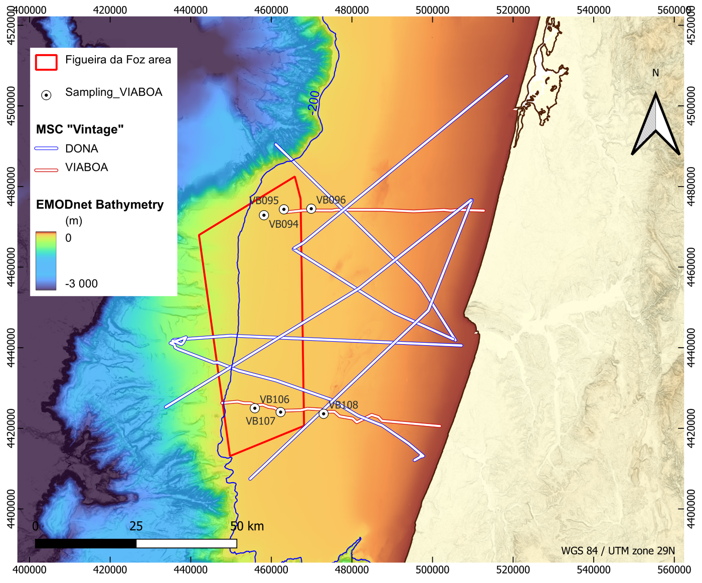
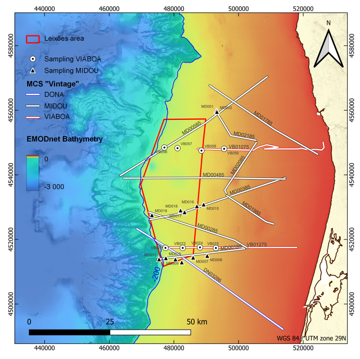
- Scarse 2D high resolution vintage seismic data from the 90s
- Original seismic data were in printed format
- Converted to digital SEGY format
- Positioned using navigation information and geometrical corrections
- Sampling rates were homogeneized and missing data were interpolated
- Geological maps from EMODNet-Geology
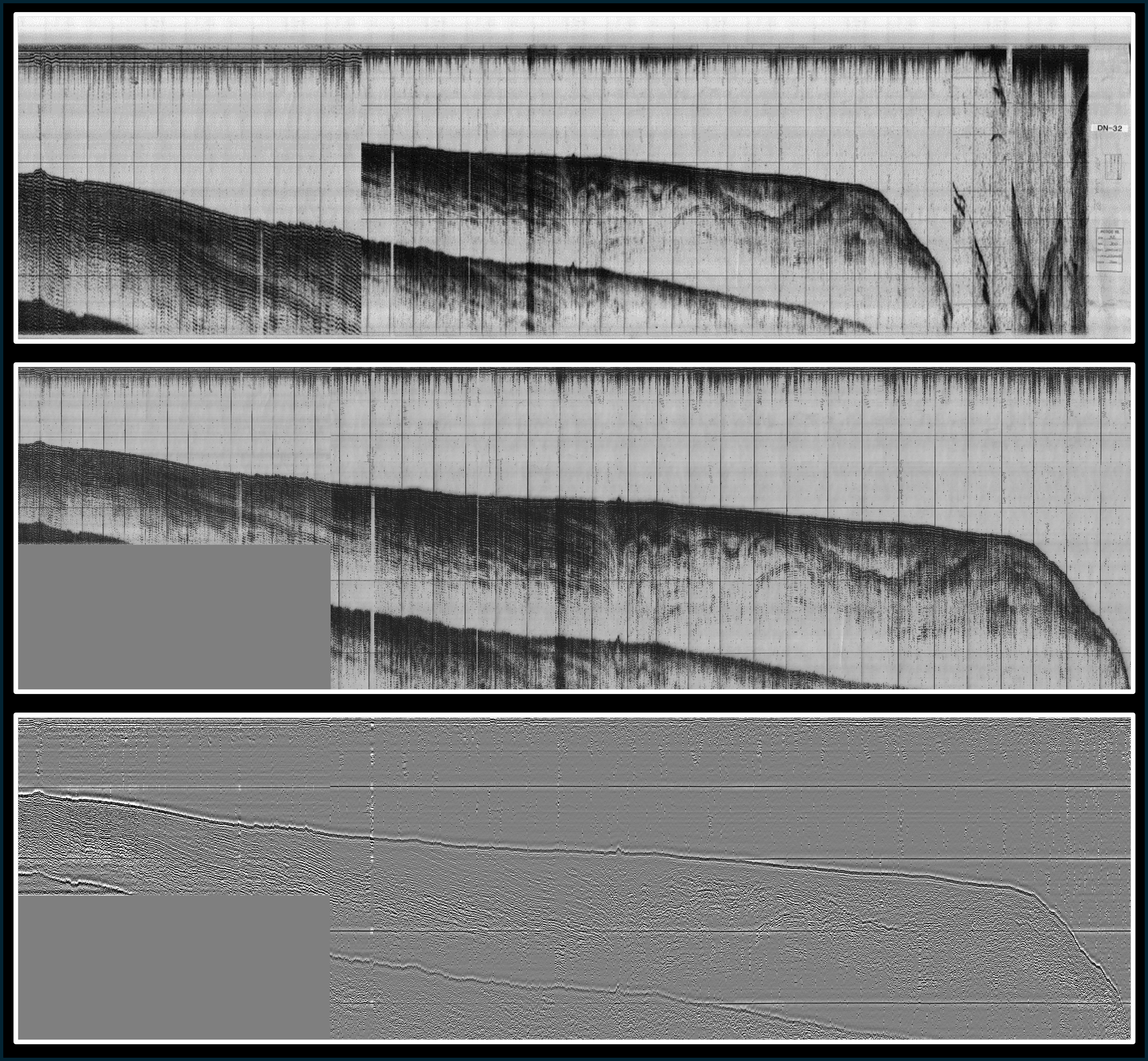
Top: original seismic profile in original printed format.
Center: restoration of the seismic line to a common depth scale, after conversion to seg-y data.
Bottom: Temptative processing of the seismic data (by the SEISLAB team).
Hindcast analysis
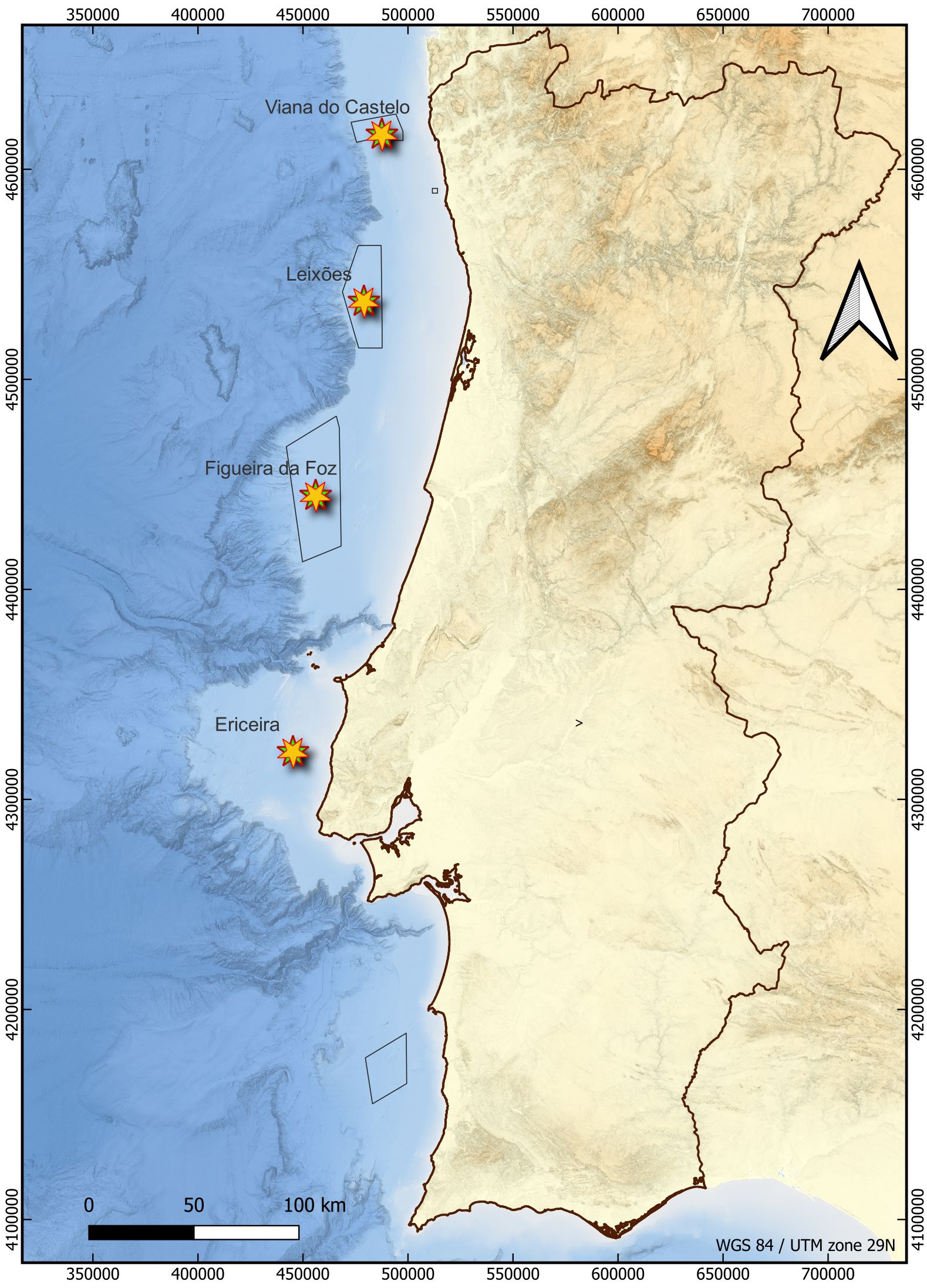
A study on persistency analysis of metocean conditions was commissioned by IPMA to Hermess.
>> Four locations: PAER areas of Viana, Leixões, Figueira da Foz and Ericeira
(Ericeira was disconsidered after the 02/2025 revision of the PAER)
>> Time series analysis of 43 years data (1980-2023)
>> Determination of:
- Workable 12h windows for operable wind and wave conditions
- Expected delay waiting time (stand-by) for operable wind and wave conditions
>> Studied conditions for Wind speed (U) and significant wave height (Hs):
- Hs < 1.5 m & U < 10 m/s (optimal conditions for data acquisition)
- Hs < 2 m & U < 12 m/s (marginal conditions for data acquisition)
- Hs < 1.5 m
- U < 10 m/s
- Hs < 2 ma
- U < 12 m/s
Archaeology
IPMA commissioned to ERA-Arqueologia a bibliographic research study on the potential of marine archaeological occurences in the PAER and surroundings areas.
>> PAER areas: Viana do Castelo, Figueira da Foz and Leixões
Aims:
- Characterize the historical maritime use of the region
- Identify the occurrence of potential archaeological sites in the study areas
- Characterize the reference situation and classify the degree of impact of the work on heritage sites
- Assess the potential presence of unexploded ordnances (UXO) amongst the identified occurrences
- Define measures to minimize the impact of the work on cultural heritage
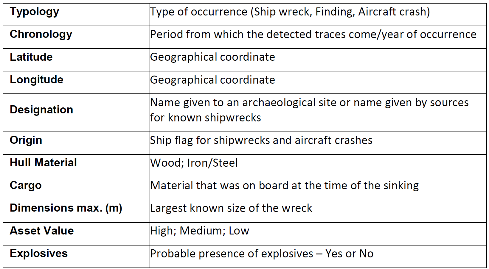
>> Potential occurences were classified according to the classes: shipwreck, aircraft crash, finding, undetermined.
>> Contact us for more information
