The 2025 survey will provide high-resolution mapping and characterizationof the seafloor and sub-seafloor geology and structures, with relevance for OWF instalation.
The 2024 results will be expanded by increasing the spatial data density in 10 times and acquiring additional data sets, for the PAER areas of Figueira da Foz and Leixões.
Aims
Methods
>> Full mapping of seafloor, including bathymetry and backscatter
<< Multibeam echosounder (MBES) and side scan sonar (SSS)
>> Characterization of the shallow geology up to 15 m bsf
<< Sub-bottom profiler (SBP)
>> Characterization of the deep geology up to 100 m bsf
>> Classification of seafloor features, infrastructures, targets, debris, or obstructions
<< MBES and SSS << Transverse gradiometer/magnetometer (TVG/MAG)
>> Determination of the geotechnical properties of the shallow sediment layers
<< Grab sampling, vibrocoring (VC), and cone penetrating testing (CPT)
>> Habitat mapping
<< MBES, SSS, sediment data
>> Identification, mapping and risk assessment of geohazards* and anthropogenic hazards**
<< All data
______
*Geohazards: geological features with potential to pose risk to one or more aspects of the proposed activity or development at a site. Examples: boulders, channels, faults, mass transport deposits (MTDs), fluid bearing sediments, gas traps, etc.
**Anthropogenic hazards: man-made objects on the seafloor or buried that may pose risk to the proposed activities or development. Examples: shipwrecks, aircraft crashes, sunken cargo, archeological sites, undetermined obstructions, military ordnances, etc.
______
Aims & Methods
>> Full mapping of seafloor, including bathymetry and backscatter << Multibeam echosounder (MBES) and side scan sonar (SSS)
>> Characterization of the shallow geology up to 15 m bsf <<Sub-bottom profiler (SBP)
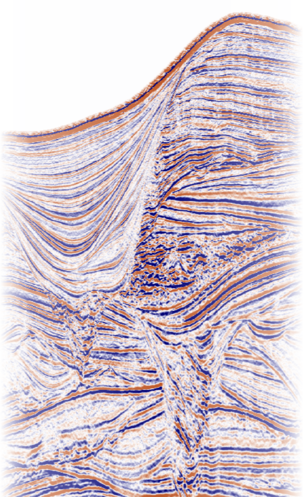
>> Characterization of the deep geology up to 100 m bsf << 2D ultra-high resolution (UHR) multi-channel seismic (MCS)
>> Classification of seafloor features, infrastructures, targets, debris or obstructions << MBES and SSS << Transverse gradiometer/magnetometer (TVG/MAG)
>> Determination of the geotechnical properties of the shallow sediment layers << Grab sampling, vibrocoring (VC), and cone penetrating testing (CPT)
>>Habitat mapping << MBES, SSS, sediment data
>> Identification, mapping and risk assessment of geohazards* and anthropogenic hazards** << All data
______
*Geohazards: geological features with potential to pose risk to one or more aspects of the proposed activity or development at a site. Examples: boulders, channels, faults, mass transport deposits (MTDs), fluid bearing sediments, gas traps, etc.
**Anthropogenic hazards: man-made objects on the seafloor or buried that may pose risk to the proposed activities or development. Examples: shipwrecks, aircraft crashes, sunken cargo, archeological sites, undetermined obstructions, military ordnances, etc.
Survey details
Operations
The execution of the 2025 geophysical survey was contracted to Ocean Infinity.
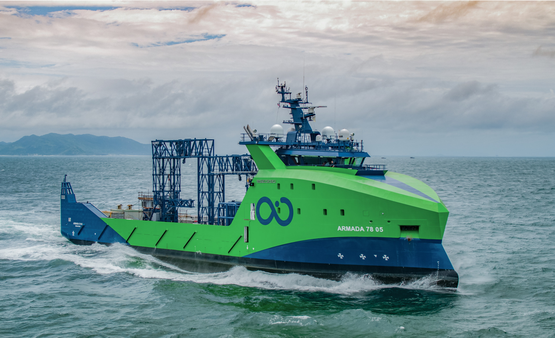
Ocean Infinity uses an innovative,fuel-efficient vessel fleetwhere a skeleton crewensures all the onboard operations for geophysical and geotechnical data acquisition. Data QC, processing and payload are conducted real-time in a remote control center.
Vessels 7803, 7805 and 7808 of the Armada fleet – class 78, were used to acquire geophysical data at single pass on each survey line.
Vessels 8601 and 8603 of the Armada fleet – class 86, were used to acquire geotechnical data.
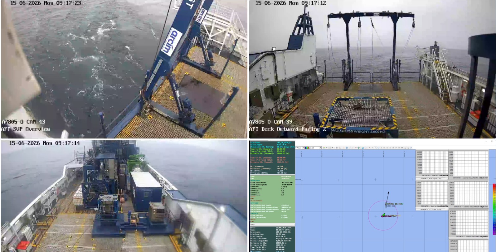
The SEISLAB team participated closely in real-time monitoring and decision-making processes at the Ocean Infinity’s remote operational centerin Gothenburg.
Vessel 7805 of the Armada fleet
Remote monitoring of offshore operations
Line planning
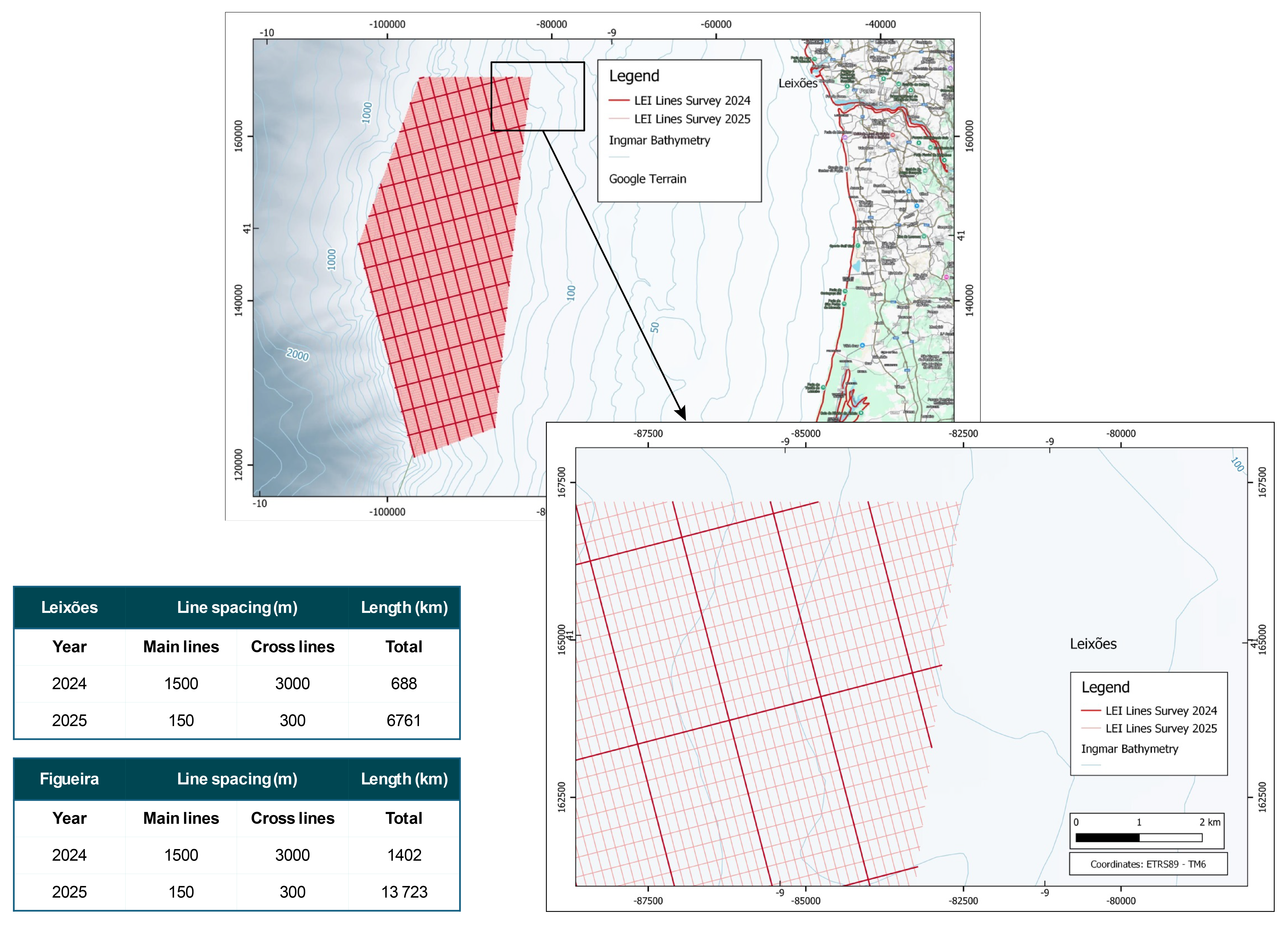
Survey lines for geophysical data acquisition were planned to provide high horizontal resolution, with main lines spaced of 150 m and cross lines spaced of 300 m.
Example of planned lines for geophysical data acquisition, comparing 2024 and 2025 surveys. Detail for the Leixões area:thick lines – 2024 survey; thin lines– 2025 survey (10 times increase in line density).
>> Seismic processing and interpretation (Geomodel)
>> Consulting in survey management
>> Client representatives
>> Survey management consulting
>> Client representatives
>> Client representatives
>> Geotechnical consulting
Please fill in the following information (for statistical purposes only). The file – Volume V – will open in a new tab after the form has been submitted. For a new submission, please refresh the page. Contact usif you find any problems.
Please fill in the following information (for statistical purposes only). The file – Volume IV – will open in a new tab after the form has been submitted. For a new submission, please refresh the page. Contact usif you find any problems.
Please fill in the following information (for statistical purposes only). The file – Volume III – will open in a new tab after the form has been submitted. For a new submission, please refresh the page. Contact usif you find any problems.
Please fill in the following information (for statistical purposes only). The file – Volume II – will open in a new tab after the form has been submitted. For a new submission, please refresh the page. Contact usif you find any problems.
Please fill in the following information (for statistical purposes only). The file – Volume I – will open in a new tab after the form has been submitted. For a new submission, please refresh the page. Contact usif you find any problems.