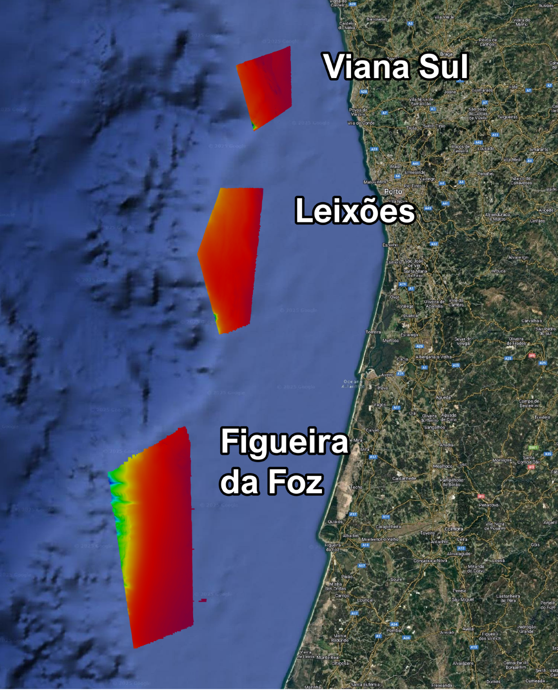
During 2024, two exploratory surveys were carried out in the areas of the Allocation Plan for Offshore Renewable Energies (Plano de Afetação para as Energias Renováveis Offshore – PAER):
Multibeam and Sampling Exploratory Survey
The multibeam echosounder (MBES) exploratory survey was commissioned by IPMA to Instituto Hidrográfico (IH).

>> Surveyed PAER areas: Viana do Castelo Sul, Leixões and Figueira da Foz
>> Acquisition of first complete mosaics of MBES data – bathymetry and backscatter
Equipment and parameters:
- Multibeam echosounder:
- Kongsberg EM 712
- Frequency band: 70 – 100 kHz
- Spatial resolution of multibeam bathymetry and backscatter models:
- 8 m for depths in 80 – 160 m range
- 16 m for depths in 160 – 320 m range
- 32 m for depths > 320 m
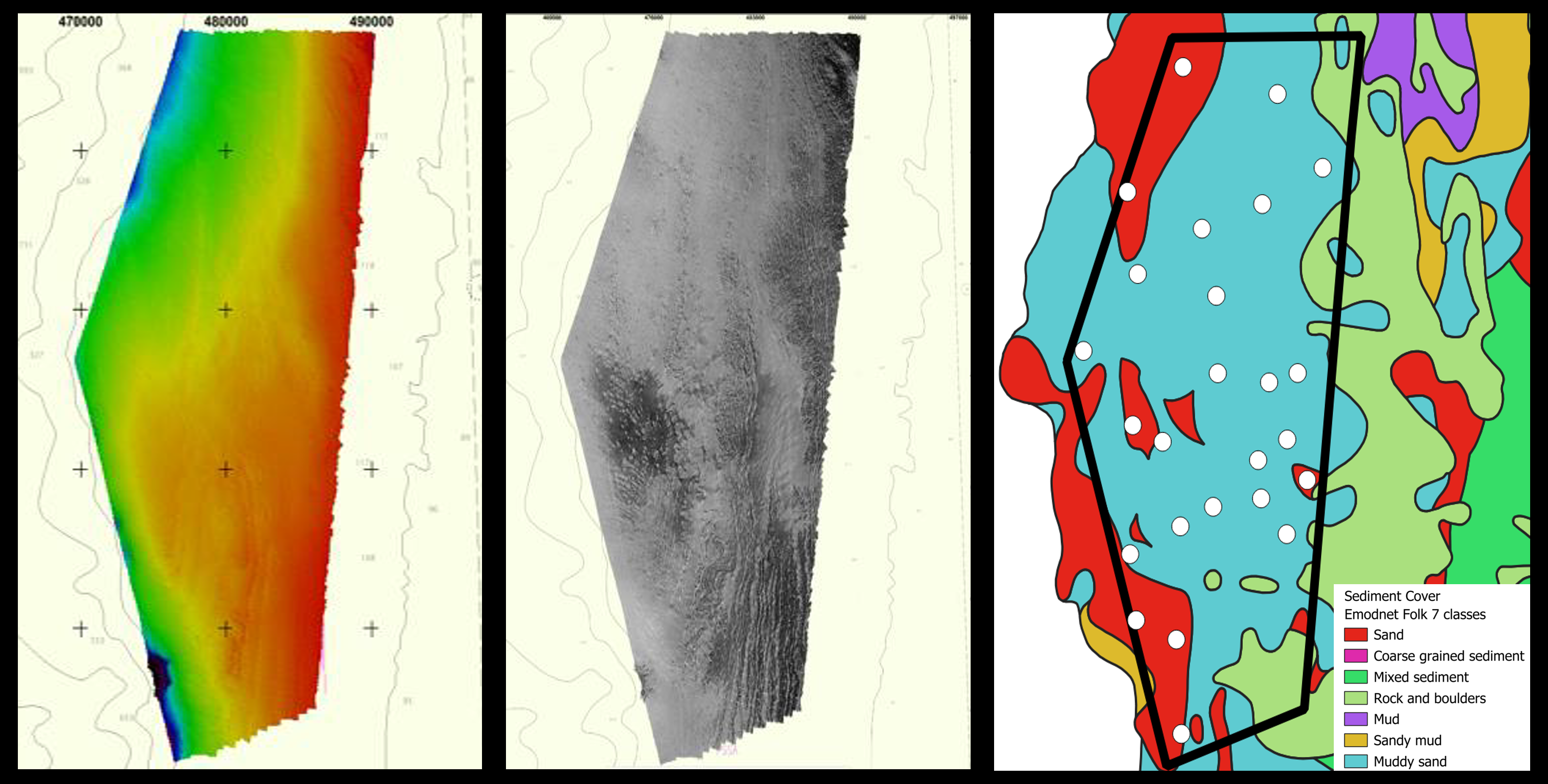
Sediment sampling
Sediment samples are used for the calibration of acoustic backscatter data.
A total of 69 sediment grab samples were collected in the three areas with a Smith McIntyre grab sampler and analysed for grain size and total organic and inorganic Carbon.
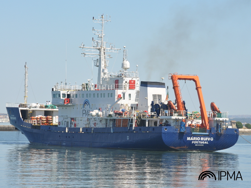
Seismic Exploratory Survey
The 2024 seismic exploratory survey was conducted onboard IPMA’s R/V Mário Ruivo
>> Acquisition of the first datasets of ultra-high resolution multi-channel seismic (UHRS) and sub bottom profiler (SBP)
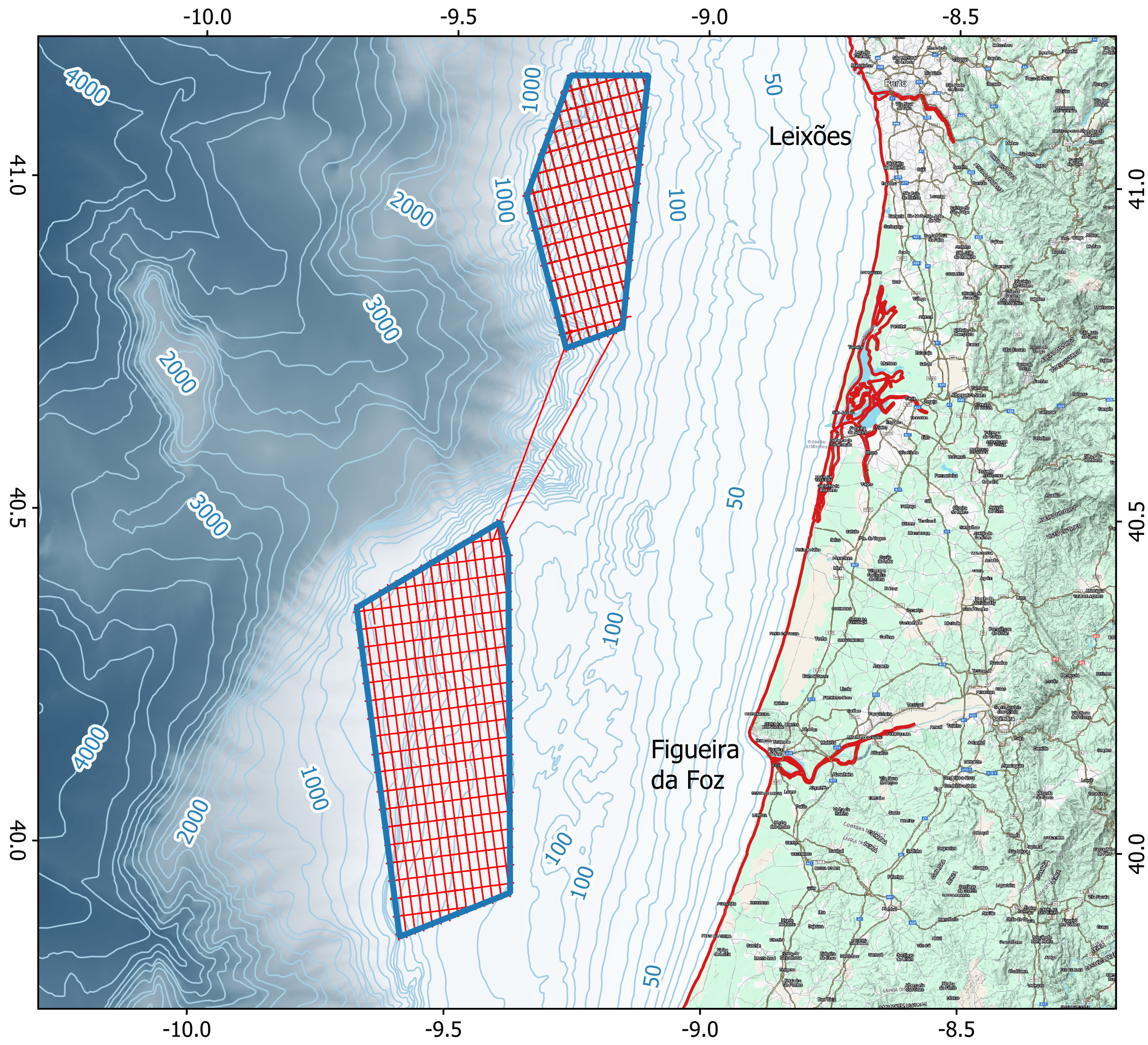
>> Surveyed PAER areas: Leixões and Figueira da Foz
>> Total 2167 km of geophysical data
>> Line spacing: 1.5 km (main lines) and 3 km (cross lines)
>> Two tie lines connecting the two areas
Equipment:
- Multi-channel seismics (UHRS):
- GeoMarine Survey Systems spread:
- Hydrophone streamer with 96 channels and 1 m group spacing
- Triple layer Sparker with 400 tips per layer (2.4 kJ)
- GeoMarine Survey Systems spread:
- Sub-bottom profiler (SBP):
- Multibeam echosounder (MBES):
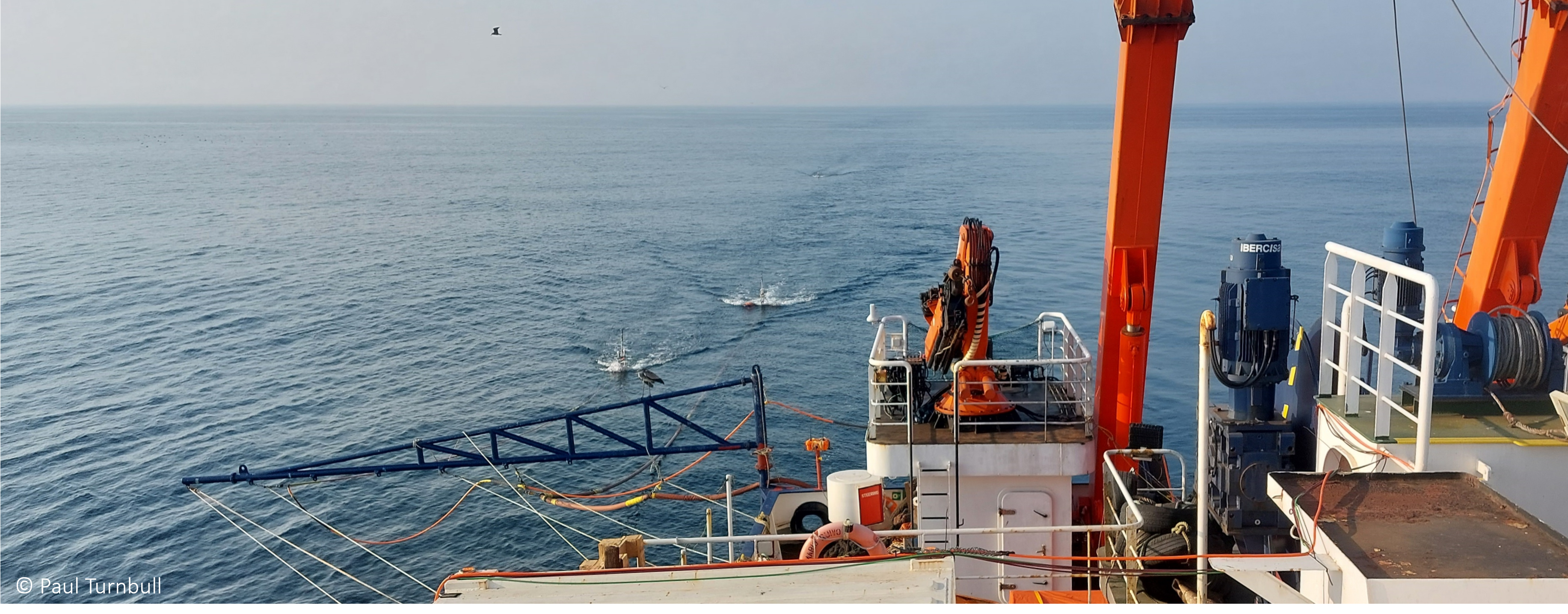
Marine mammals observation (MMO)
Continuous monitoring of marine mammals activity was ensured to mitigate the impact of acoustic noise on cetaceans.
- Direct visual observation of mammal and other fauna activity
- Passive acoustic monitoring system (PAM)
- Compliance with the JNCC mitigation guidelines

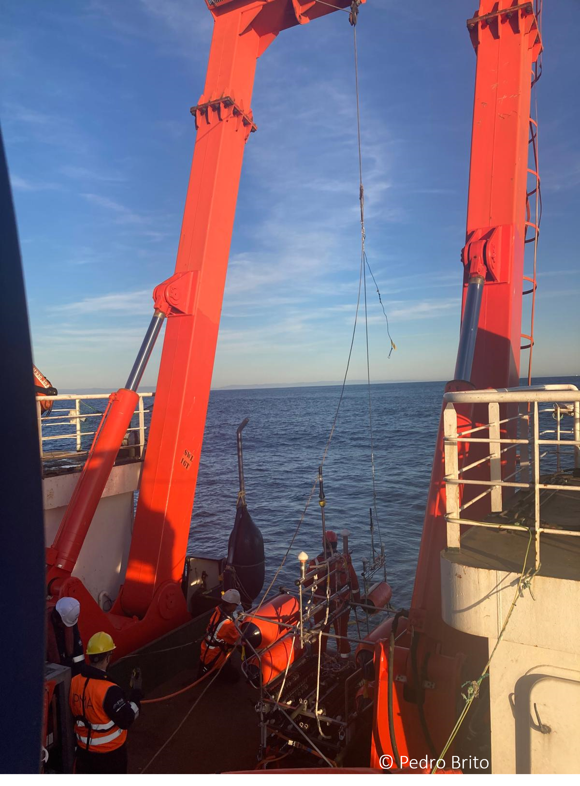

+ Photo Gallery
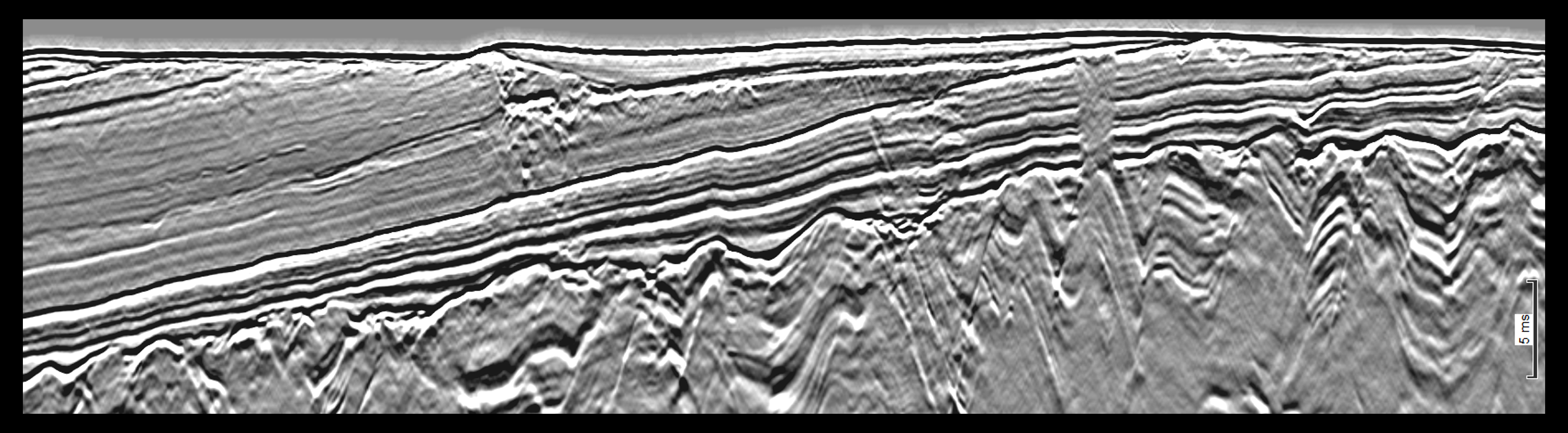
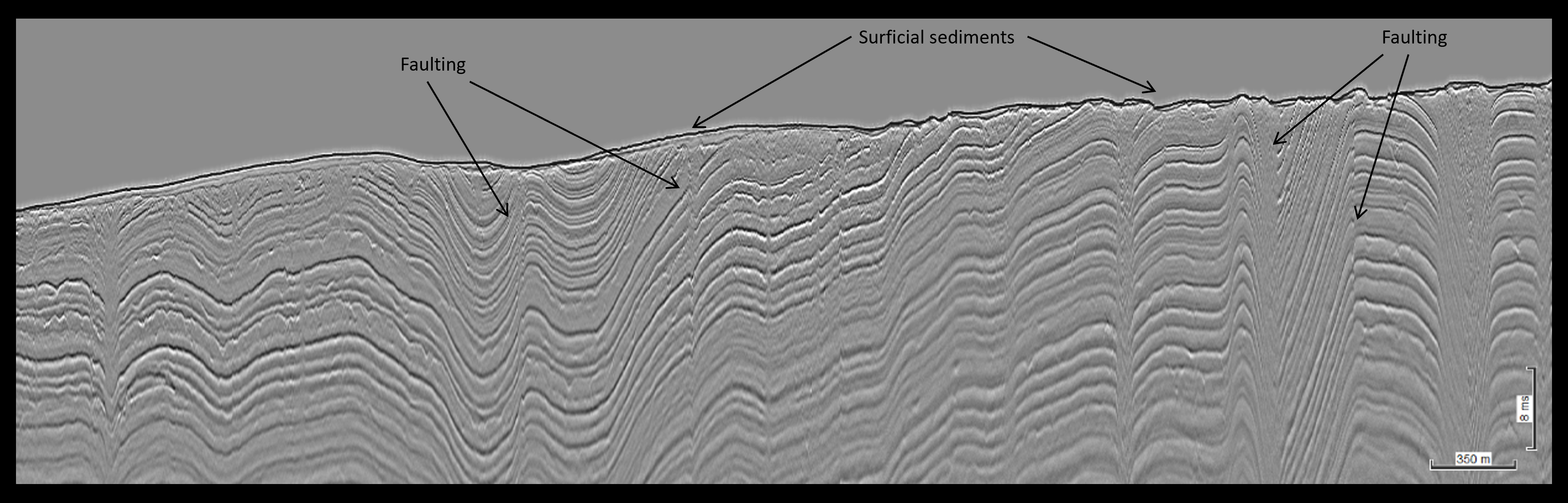
Geomodel
A preliminary Geomodel was built from the interpretation of all datasets, and includes:
- Main seismic packages
- Four horizons per site
- Geohazards (channels, faults, mass transport deposits (MTDs), fluid bearing sediments, …)
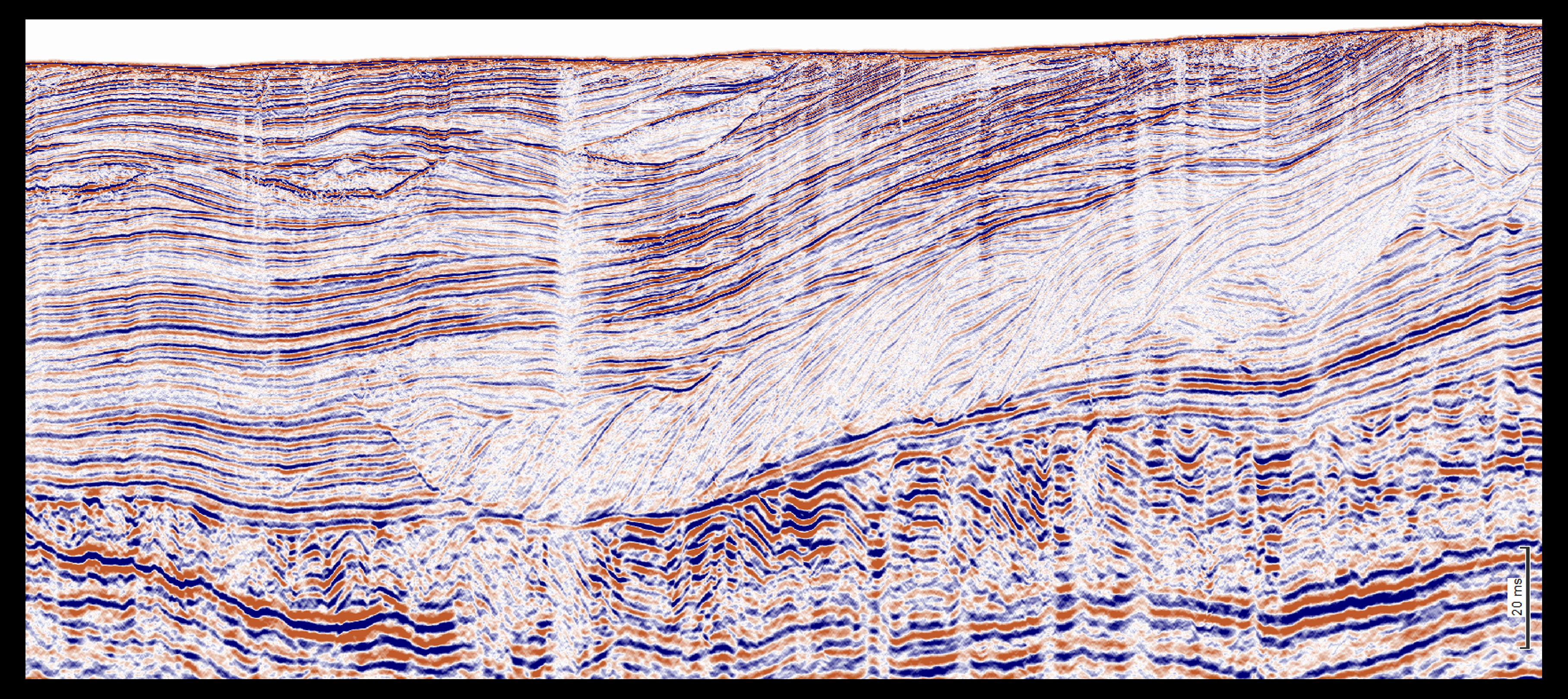
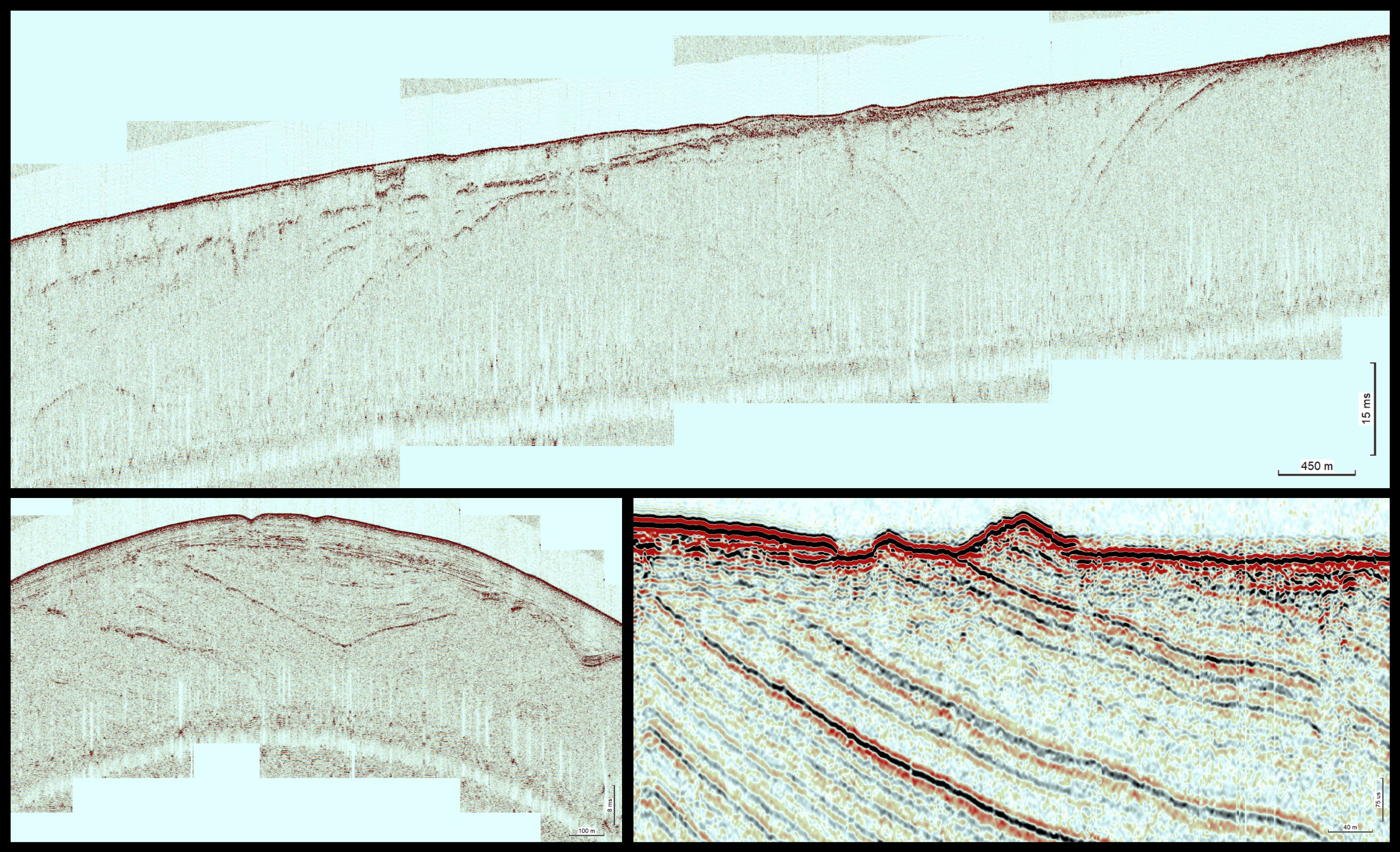
Examples of acquired data
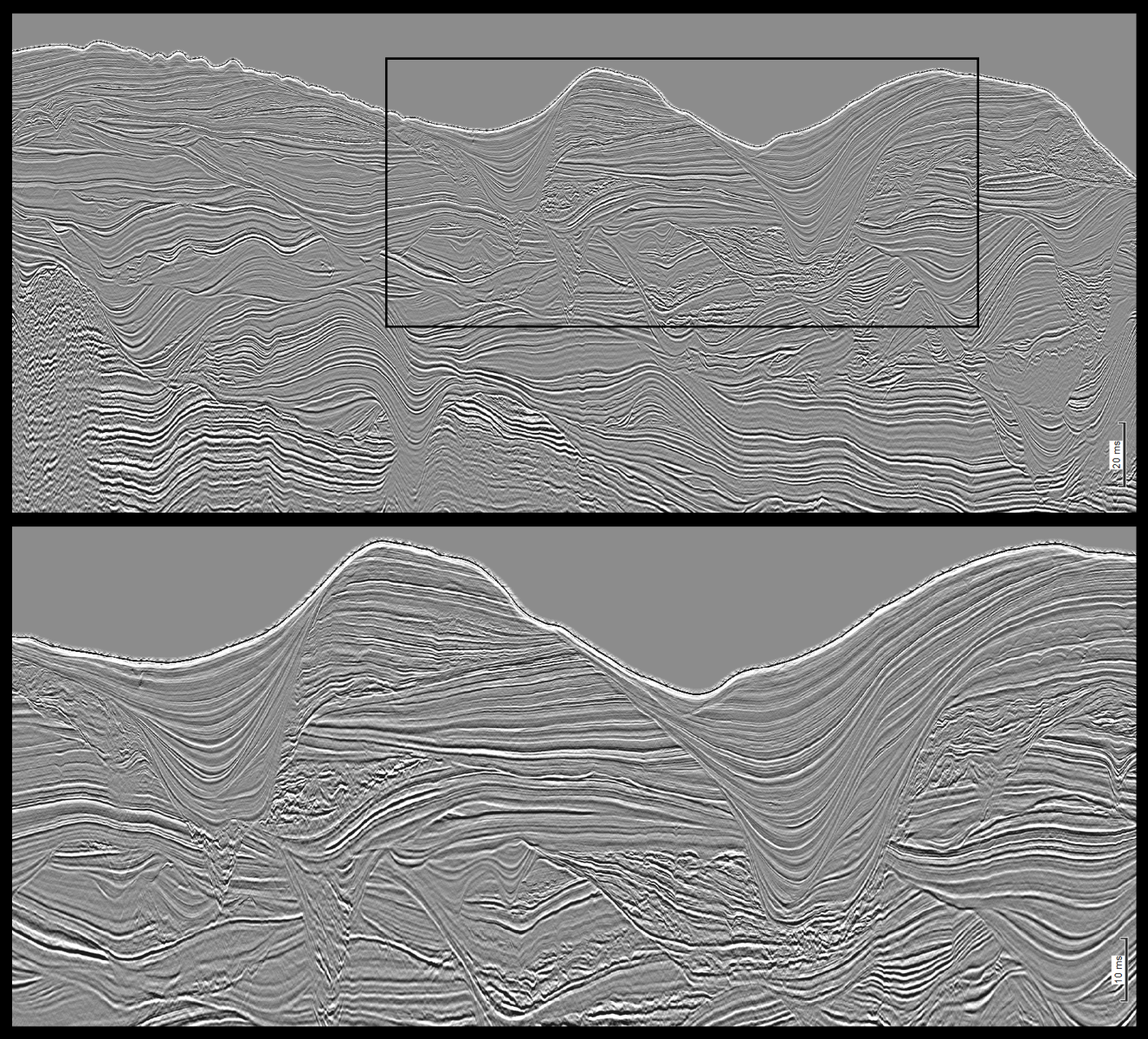
Seismic facies of channel infils in the continental slope
Survey partners and contractors

>> Coordination and MBES data acquisition and processing
>> Seismic data acquisition
>> Marine surveying technical staff
>> Consulting in survey management
>> Client representatives
>> Marine fauna observation

>> Seismic processing and interpretation (Geomodel)
>> Seismic interpretation (Geomodel)
